Supermono's Rescue Rush uses GPS data to generate 'more than a million playable levels'
Where am I?
Supermono, the London-based developer behind Mini Squadron and Forever Drive, has revealed its next iOS game. It's called Rescue Rush, and the team calls it "the first out and out arcade Location game".
What does that mean exactly?
Well, by using GPS data, the game can automatically generate a level - complete with roads, buildings, lakes, and park - that's based on your nearby surroundings.
Your city or village, then, becomes a stomping ground for Columbus the Cat. He's the result of a botched shrink ray experiment that backfired, causing the feline fur ball to expand to 100 times the size he was.
In each Rescue Rush level, you'll be attempting to escape from the evil scientists and their array of dastardly vehicles, while collecting coins and trying to unlock other caged-up animals.
If you're not one for real-world travelling, don't worry: the game won't get too samey. As you play, portals will allow you to jump to different continents around the world. You can also visit a number of instantly recognisable international landmarks from the Taj Mahal to the Empire State Building.

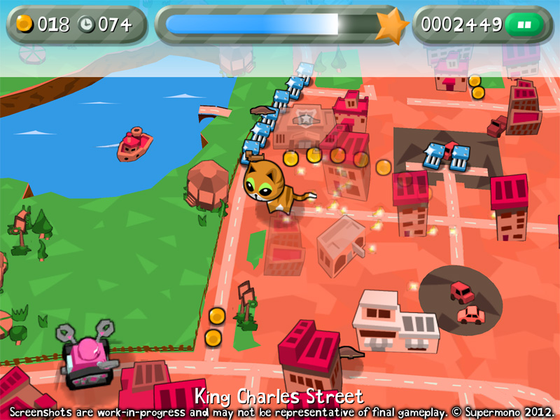
Rescue Rush, in Frakkastígur, Reykjavík, Iceland
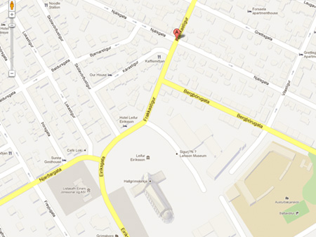
That same location on Google Maps
Rather impressively, the final version of Rescue Rush will feature "more than a million playable levels and global leaderboards". Cor, blimey.
Rescue Rush will be a freemium title, and should be available in the not-too-distant future - Supermono is "flat out trying to get the game finished" as we speak / type.
